

WINTER MAPS
WINTER MAPS
SPRING TRAIL MAP

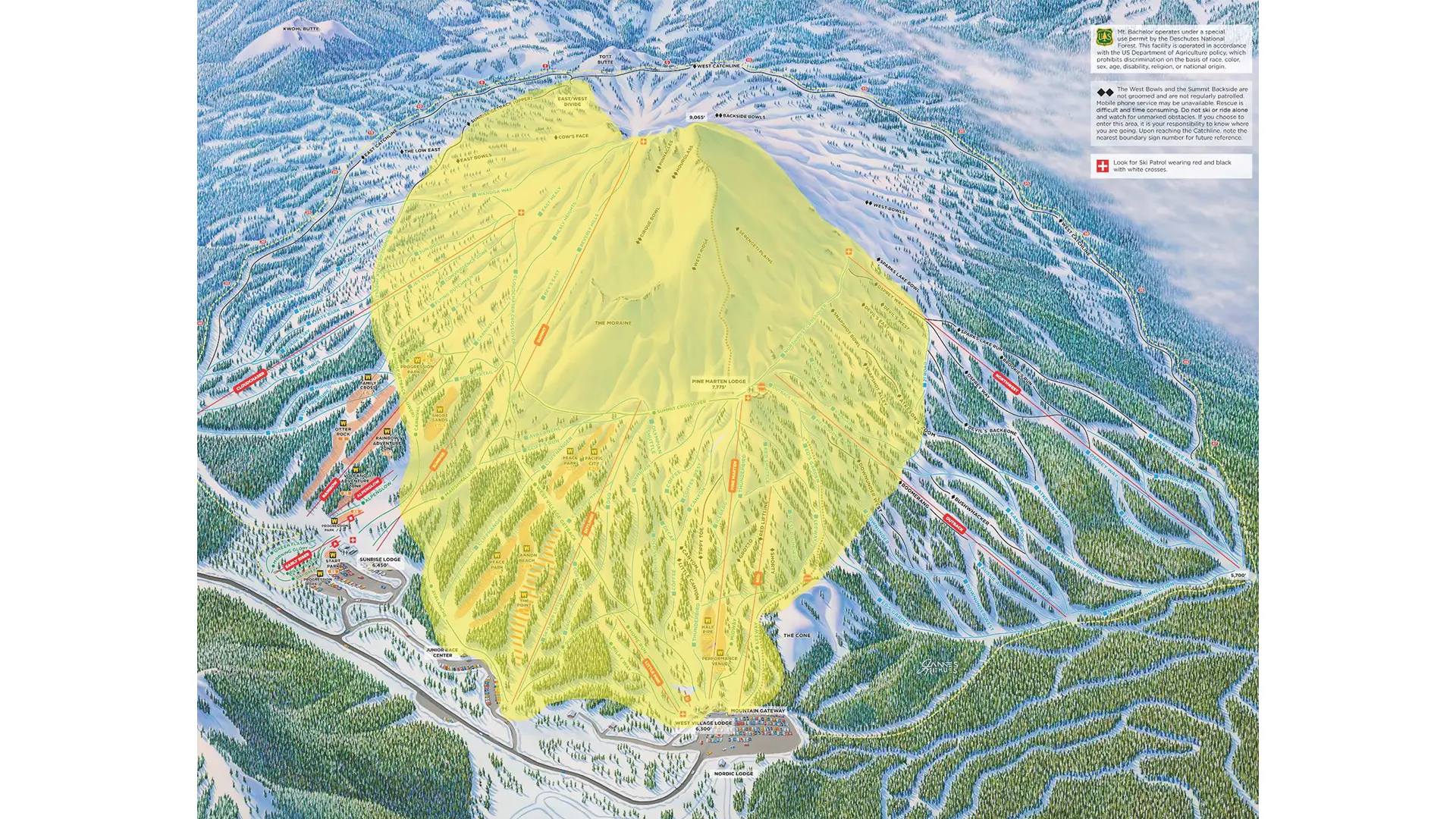
Accessible terrain is highlighted in YELLOW. All terrain outside of the yellow is OUT OF BOUNDS.
If skiing or riding near the spring boundary line, look for boundary markings and adhere accordingly.
Spring Boundaries:
- Eastside: Cow's Face into Sunrise Getback to Skyliner bottom.
- Westside: From the notch on Summit Hike down to Northwest Crossover top/Osprey Way/21 Road/to the Cone compression.